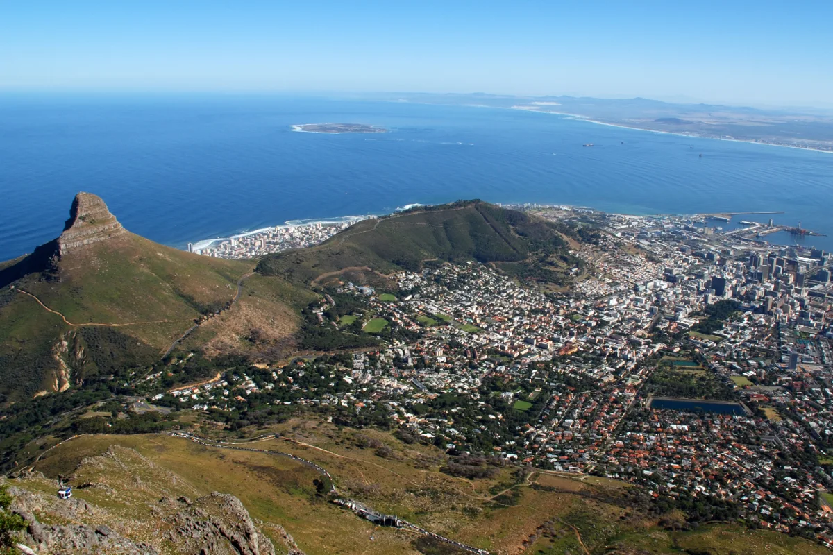
Cape Town is the legislative capital of South Africa and the capital of Western Cape Province. It lies at the northern end of the Cape Peninsula some 30 miles/50 kilometres at its southern region boundary, north of the Cape of Good Hope. The city covers an area of 300 square kilometres (116 square miles). So get an idea of Cape Town Maps before travelling!
Cape Town Destinations has beautiful physical features. One part of the city and its suburbs wind about the steep slopes of Table Mountain (3,563 feet high) and neighbouring peaks and rim the shores of Table Bay. Other parts lie on the flats below the slopes or stretch southward across the flats to False Bay.

A detailed breakdown of the geographical facts based on Cape Town Maps is given below:
Though each season has something special to offer to the visitors in Cape Town, summer is by far the most popular. This is the warmest and most crowded season runs between November and February.
The best mode of transportation to find out how to Getting Into Cape Town is via flights. Cape Town is the second most visited city in South Africa when it comes to tourism
Whether you are planning a luxury vacation to Cape Town or backpacking from region to region, Cape Town Accommodations provides the luxury.
South Africa is a world-renowned tourist destination with breathtaking landscapes, stunning wildlife, picturesque beaches, and lively and captivating cities.
In Cape Town, the weather remains warm and temperate. Summers feel warm, dry, and clear while winters are cool, wet, and sometimes cloudy.
Take to the skies in a breathtaking helicopter and experience Cape Town from the perspective of a soaring eagle.

Experience more with Cape Archives Tours, your trusted local tour operator. Discover the best of Cape Town with expertly guided tours tailored to your preferences. From iconic landmarks to hidden gems, we deliver personalized, unforgettable experiences that showcase the beauty and culture of South Africa.

Experience more with Cape Archives Tours – Passionate Travel: Explore, Dream, Discover. As your local tour operator, we craft unforgettable journeys that bring Cape Town's beauty and culture to life. From iconic landmarks to hidden treasures, enjoy personalized, expertly guided tours designed to inspire and create lasting memories.

Experience more with Cape Archives Tours – Lovely South African Destinations. Discover the charm of South Africa with our expertly guided tours, showcasing breathtaking landscapes, vibrant cultures, and rich history. From stunning coastlines to iconic landmarks, we provide personalized experiences that make your journey unforgettable and truly extraordinary.
Cape Town is also known as the mother city, which is the legislative capital of South African Destinations. The city covers an area of 116 square miles (300 square kilometers) from Cape Point to Melkbos and False Bay. Cape Town outgrew its original purpose as the first European outpost at the Castle of Good Hope, becoming the economic and cultural hub of the Cape Colony.
The main airport servicing the city of Cape Town is the Cape Town International Airport(CPT). This is the second-largest airport in South Africa. The airport is located around 12 ½ miles from the city center of Cape Town.
After reaching the airport, you will be transferred to your hotel by your travel operator. Otherwise, there are a number of transportation options available at the airport including taxis, buses, and rental cars.
Cape Town is a beautiful city and a perfect place for shopaholics. There are many different Cape Town Shopping experiences and things to shop for in the city. You can easily find anything you want while you travel in the Mother City.
You can go on shopping tours and explore malls, luxury boutiques, waterfronts shop, and bustling marketplaces and pick up items of your choice.
The V&A Waterfront features 150 shops and over 365 different brands and souvenirs, the galleries and designer shops found around Church and Bree Street The Green Point Market offers one of the best flea markets every Sunday.
Cape Town also known as ‘Tavern of the Seven Seas’ is bursting with restaurants, bars, nightclubs and other nightlife attractions on every corner of the city. The V&A Waterfront is the most happening location in the city in the daytime and at night time you can enjoy the best sunset, great night events with live music and plenty of places to eat and party.
Although Cape Town is a safe Place To Visit In South Africa, you have to be aware of something while travelling in Mother City. There are some concerns when it comes to travelling alone in Cape Town. Don’t travel after dark all alone and don’t use expensive jewellery while travelling alone in the city.
It really depends on what you are coming to Cape Town for. However, if you are a fun lover, we'd recommend Cape Town Accommodations somewhere near Sea Point, Green Point, Bantry Bay, Clifton, or Camps Bay. All these places are close enough to the city, main tourist attractions, and beaches. Blouberg is suitable for Kite Boarding, Surfing, and Wind Surfing. Muizenberg, Saint James, Simons Town, Kommetjie, and Noordhoek town are beautiful and great for a slow experience and surfing.